Minneapolis Unveils Map of Authorized Cannabis Dispensary Locations
The City of Minneapolis has released a map outlining the areas where cannabis dispensaries are permitted to operate. The map is a crucial step in the city’s efforts to regulate the sale of medical cannabis products.
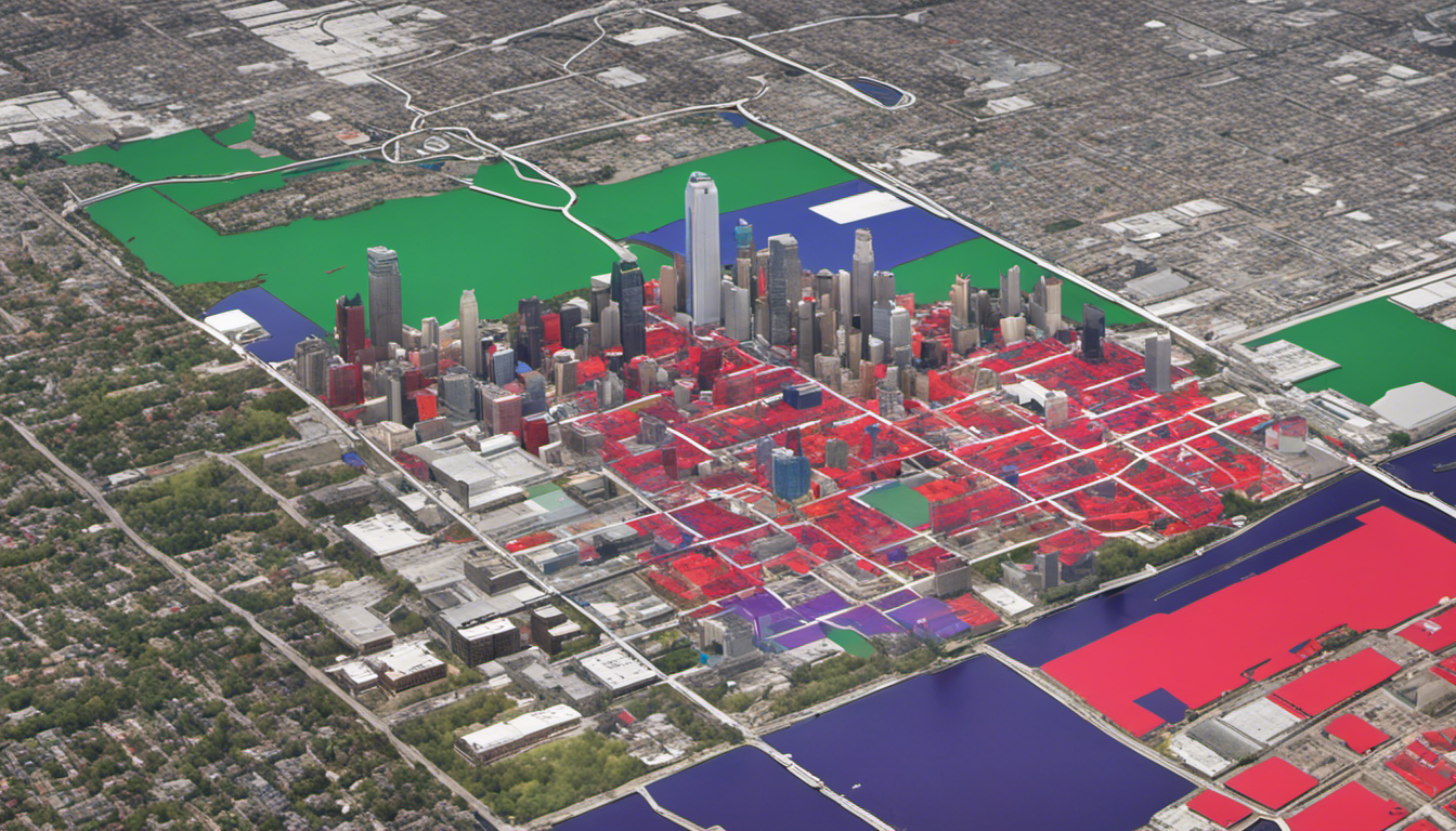
According to the map, dispensaries must be located at least 300 feet away from K-12 schools. The map also highlights areas that are zoned for industrial or commercial use, which are eligible for dispensary operations. These areas must be at least three acres in size and allow for dispensary operations.
The map is color-coded, with red, blue, and purple areas indicating parcels that are zoned properly for dispensary operations. Gray areas do not currently allow for dispensaries, and blue areas are buffers around K-12 schools that dispensaries must maintain a 300-foot distance from.
The city recommends searching for specific addresses on the map to obtain more detailed information about a location’s zoning status. However, it advises against relying solely on the map for land use verification, and instead encourages residents to contact the city’s planning department at 311 for more information.
The map does not provide information on the location of cannabis cultivation or manufacturing businesses. The city is expected to issue retail cannabis licenses in the near future, but it remains unclear when the state’s self-contained marijuana market will be fully operational.
Residents can view the map on the City of Minneapolis’ website to learn more about the authorized dispensary locations in their area.